Which towns and cities are at risk of flooding in southern Scotland?
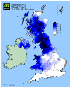
Scotland is known for it’s beautiful countryside and rich history, but it is often also associated with the bad weather and bouts of flooding which come with its geographical location. Listed as a temperate country, you won’t find some of the extreme conditions you would in some of the more northern reaches of the country, but the constant low temperatures (and average of 0℃ during winter) are not the most pleasant.
It seems that nowhere is truly safe from the grim conditions which come with living in southern Scotland, and with this in mind we’re going to take a look at some of the major southern cities to establish just what the flooding risks are in Scotland, as well as spelling out what the different types of flooding are.
What types of flood risk are there in Scotland?
The flood risks in Scotland fall into three different categories, with the severity of each depending somewhat on the intensity of rainfall, winds and how saturated the land is already. The categories for flooding risks are as follows:
River flooding
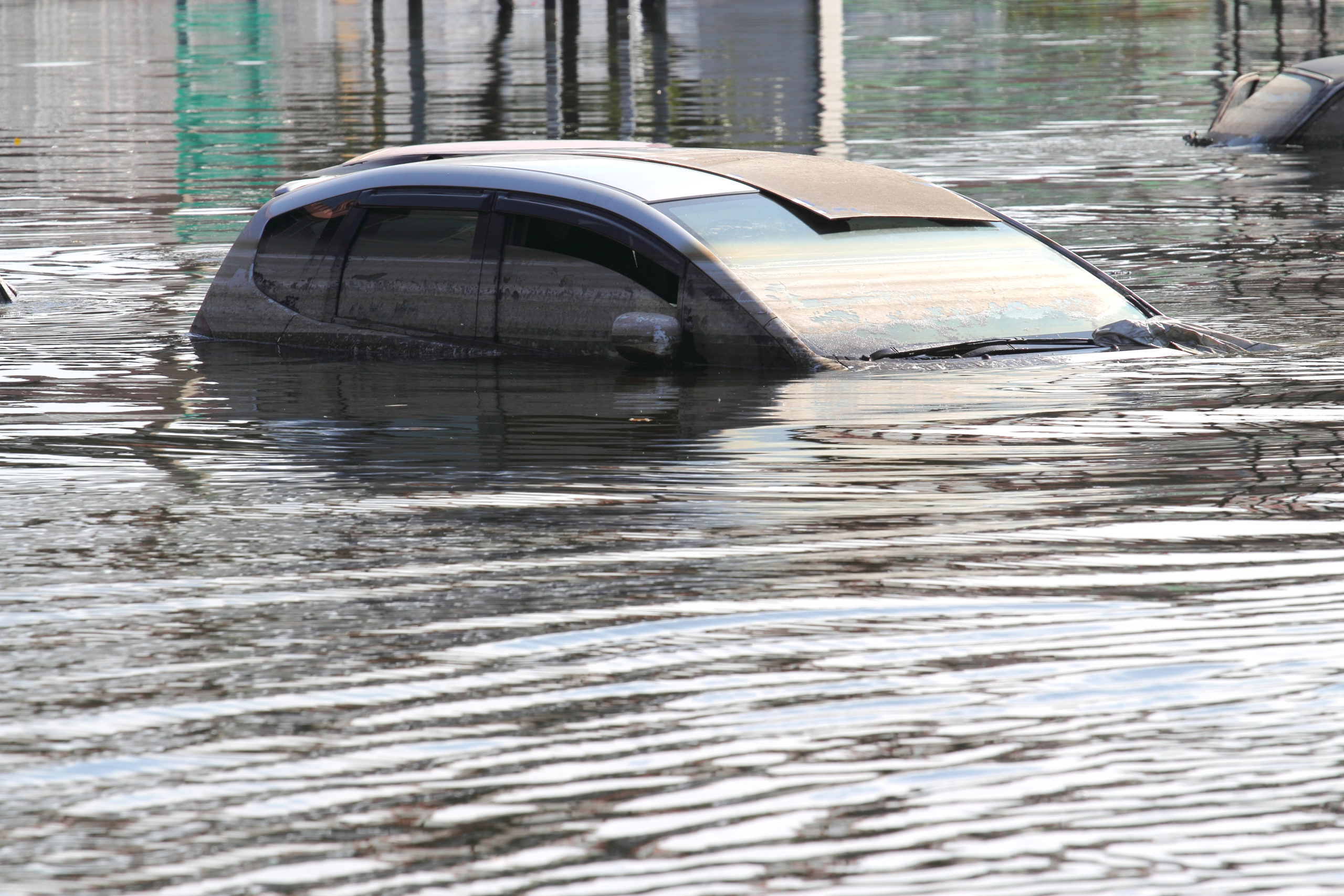
Sometimes referred to as fluvial, river flooding is usually owed to heavy rainfall in a short space of time. When this occurs, it’s usually called a flash flood, sending a greater amount of water down a river or stream than it usually handles. This increases the speed of the water, helping it pick up and hurl debris downstream.
A lot also depends on the defences in place and soil saturation levels. Where surrounding land has already been soaked by rain, the river overflow will simply keep spreading. One of the major hazards of this is that a river flood could bring with it mud, silt and possibly sewage to any home or business impacted by flood waters.
The movement of river flooding is stronger than we may think, damaging property, moving earth and sweeping items away in its current – including those people who brave traversing it.
Surface water flooding
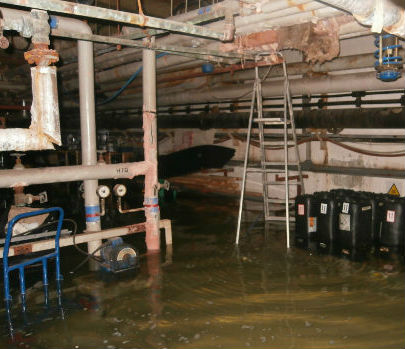
Many people who are far enough away from coastal regions and rivers or other bodies of water think they will never be flooded – this is not correct. Pluvial floods, more commonly known as surface water flooding, can appear independent of other bodies of water.
Where there is heavy rainfall in a short period and poor drainage, there is an accumulation of water. Those in low lying areas will see rainwater falling from hills and forming where the drains have become overwhelmed. This intertwining of flood water with sewer systems can bring with it greater health risks.
It’s difficult to deal with surface water flooding, because when the drains nearby can’t handle the water, there is nowhere to move it to. Property affected by this flooding must simply wait it out or seek professional assistance.
Coastal flooding
Coastal flooding, or a surge flood, is pretty self explanatory. Where there is a coastline shared with the ocean – or other large body of water – there is the risk of tidal waters surging beyond their usual levels. Extreme winds are usually at fault, whether they’re produced close to the shore or further out.
Low lying land is most at risk, simply because it’s easier for the water to wash further inland. Beach erosion is the first point of damage, risking property built on the very edge of the land, but coastal flooding further inland is equally as damaging, taking out roads and transport links as well as overwhelming properties which might not usually expect flooding.
The direction of a storm over the water plays a huge part in how devastating the impact is, as if the storm shunts water directly at the face of the coast it will have a much speedier impact.
Southern Scotland Flooding Risks
Aberdeen
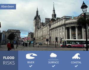
Sitting on the east coast of Scotland, there is plenty for residents of Aberdeen to factor in when it comes to flood risks. The coastline itself is considered a huge flood risk from coastal flooding, particularly around the mouth of the River Dee.
River Dee is at the south of the city centre, while the River Don sits to the north, both meeting with the North Sea. The rivers themselves obviously pose a flood risk, but the areas surrounding them are also highlighted as flood risks due to banks which are liable to burst in a downpour.
Surface water is likely to cause issues in patches throughout the region, compounded by heavy rain, especially when close to other bodies of water. Residential areas are most susceptible to this, but important locations, such as the Royal Cornhill Hospital, are also at risk of flooding from surface water.
Ayr
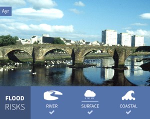
Ayr is located on the west of Scotland, with the Firth of Clyde running along the coast. This stretch of coast is highly susceptible to coastal flooding, especially in the area surrounding the mouth of the River Ayr. Businesses located in these areas face a persistent threat as well as those in the Seafield district.
The River Ayr cuts straight through the heart of Ayr and out into the sea, presenting itself as a flood risk throughout its journey west. There are also plenty of medium risks along this river and the other smaller rivers such as the River Doon, with many warehouse and manufacturing spaces at risk should these rivers burst their banks.
In both residential and rural areas across Ayr there are high risk patches for flooding from surface water. Concentrated patches may not affect everyone but important locations could be waterlogged and homes face flash flooding in the event of a heavy downpour.
Cumbernauld
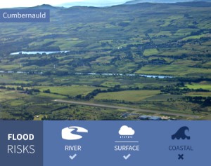
Luggie Water to the south-west of Cumbernauld is very likely to flood, particularly in the Condorrat area where many other smaller rivers meet Luggie Water. Coming in from the north there is also the Red Burn which poses a threat to the rail lines and the residents of Kildrum to the west.
Surface water ranges from a high risk to a medium risk in large portions of the Cumbernauld region, impacting important transport routes such as the M80. Fannyside Loch is listed as a high risk of flooding, with the Garberthill Burn nearby to compound the danger.
Because of its central location, Cumbernauld is a town which sees absolutely no threat from coastal flooding. Instead, issues with flooding come chiefly from the array of burns surrounding the town and from surface water accumulating.
Dundee
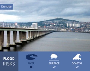
The mouth of the River Tay widens and narrows again as it reaches the ocean, which registers the whole region as being at risk from coastal flooding. Dundee is on the north of this mouth, placing all homes and business along the coast at risk.
The risk from surface water flooding comes a touch further inland from the coast, impacting on rail lines and the major A991 route at the heart of Dundee. Patches of surface water risks appear throughout the city, signalling that a heavy downpour could affect multiple homes and businesses at any time.
The Dighty Water runs from west to east to eventually find its way to the Tay, but it straddles the north of Dundee, posing a flood risk on its eastern stretches. Residential property, as well as commercial property, is at risk here, with those in the West Pitkerro Industrial Estate just a handful of business who could suffer if the Dighty Water bursts its banks. Most of the river flooding risks however, come outside of the main populated regions.
Dunfermline
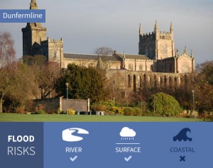
The Lyne Burn, which winds its way through the city to meet with the Firth of Forth at Charlestown poses an extreme risk between Torryburn and Crossford. Meanwhile, to the east, Inverkeithing is hampered by numerous small rivers meeting, posing a threat to the rail lines and any surrounding homes and businesses.
Swathes of Dunfermline face a high risk of surface water flooding, particularly close to the coast in Rosyth, but also further north close to reservoirs. Where the Brankholm Burn meets the B980 road, river flooding and surface water flooding combine, doubling the risk. Sitting on the northern side of the Firth of Forth, Dunfermline is at risk from coastal flooding on its southern edge which meets the shore. Businesses and home on this southern coast line are therefore most at risk from coastal flooding.
East Kilbride
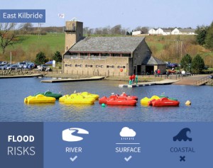
Calder Water to the east of the city poses a high level risk to surrounding areas in East Kilbride, while the Kittoch Water makes it’s way through the heart of the city. More of a threat to rural areas where these waters meet others, Eaglesham faces extremely high risks of flooding from rivers.
Schools, roads, homes and businesses in the centre of East Kilbride are swamped by surface water flooding risks. While rivers only compound the dangers, even those areas far enough away from bodies of water could see flash flooding in heavy rain.
Far from the coast, East Kilbride faces zero coastal flooding risk, but homeowners and businesses may have plenty to contend with when it comes to rivers and surface water.
Edinburgh

Edinburgh, the capital of Scotland, faces a raft of flooding issues, with coastal flooding along the length of its shoreline a major issue. From Queensferry to Musselburgh, there is always the risk of water making its way up the coast and inland.
Rivers blight the city in terms of potential for flooding, with the Water of Leith cutting through the city posing problems right the way through. The BT Murrayfield Stadium and the surrounding area show high and medium levels of risk far beyond the banks of the river. To the east, the Duddingston Loch and numerous burns all bring with them high levels of risk for flooding.
Surface water risks litter the streets of Edinburgh, a huge cause of concern for homeowners and business owners as a heavy downpour could always be right around the corner. Within the A720 there are few areas of Edinburgh not at some kind of risk from surface water flooding.
Glasgow
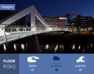
Because of the River Clyde leading into the Firth of Clyde, there are large parts of Glasgow to the west at risk from coastal flooding, particularly in the Renfrew area. But even at the heart of Glasgow in the Finnieston region, there are high, medium and low risks to the area.
River flooding is a major risk to the east of Glasgow with the winding of the Clyde resulting in many regions under water. Richmond Park is awash with medium risk here, while the White Cart Water to the south also brings huge stretches of flooding risks.
Much like Edinburgh, Glasgow is peppered by surface water flooding risks, particularly between rivers and coastal flooding risks. Homes and businesses in the city centre could be hit hard in torrential rain.
Hamilton
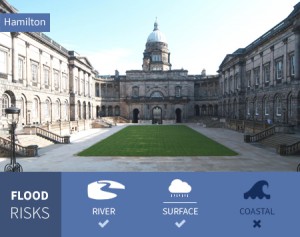
The River Clyde and the Strathclyde loch are a deadly combination for flooding, covering huge areas in the north-east of Hamilton with high and medium risk listings. A litany of burns and smaller rivers and brooks combine through the centre of Hamilton to bring disruption to the local area too, particularly along Gow’s Linn.
Though most flood risks are associated with Hamilton due to rivers, surface water flooding is highly likely in many areas of the city. Blantyre and Burnbank hold large patches of medium and high risk areas, while Bent Cemetery at the heart of the city is also at risk. Hamilton faces zero coastal flooding risk, being further inland than Glasgow, but shares some of the worst river flooding risks with neighbours Motherwell.
Inverness
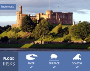
Caught between the Beauly Firth and Moray Firth, the Inverness coastline is listed as being at risk from coastal flooding, particularly where the River Ness flows into the eastern end of the Beauly Firth. This leaves many businesses and industrial operations open to the risk of coastal flooding.
The Caledonian Canal and the aforementioned River Ness wind their way through Inverness in tandem, presenting a high risk in the city areas. The entire tip of Inverness faces a low risk at the very minimum, causing great alarm to any homeowners and businesses in the region.
Besides the coastal and river flooding, Inverness also faces surface water flooding. Kinmylies is a prime example of an area awash with high and medium level flood risk warnings.
Kirkcaldy
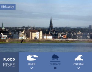
Kirkcaldy sits on the coastline where the Firth of Forth flows out into the North Sea, this creates a high risk of coastal flooding along the length of Kirkcaldy’s shore. The Wharf at the centre of the shoreline faces the real possibility of coastal flooding, with the East Burn complicating matters.
Surface water flooding in the exact same area doubles the risk, while Beveridge Park also suffers from high surface water flooding risks. Kirkcaldy sees other stretches of surface water flooding risks throughout the city, making a heavy downpour a worrying sight.
Raith Lake and Tiel Burn present the biggest risk to homeowners and those with businesses in more developed areas of Kirkcaldy for river flooding. Despite being relatively small, the Den Burn threatens a low risk of flooding over a large area, an area which completely covers Victoria Hospital.
Livingston
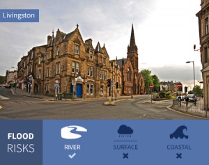
Fractured by rivers, particularly in its southern regions, there are many homes and businesses under threat from river flooding in Livingston. Along the length of the River Almond, Lochshot Burn and Killandean Burn there are multiple areas where river flooding is at risk of spreading further outwards.
Besieged by a high likelihood of surface water flooding, Livingston has some key areas which are susceptible. Where the A899 meets the A705 there is a significant risk, while further west in Carmondean there areas surrounding the rail lines are particularly vulnerable.
Livingston is just far enough away from the Edinburgh coastline that it is not under any threat from coastal flooding.
Paisley
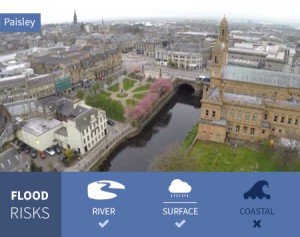
With the White Cart Water and Black Cart Water at either side of it, Paisley is awash with high, medium and low river flooding risks. The area surrounding Glasgow Airport is especially vulnerable, but there are more developed areas with homes and businesses where multiple smaller bodies of water risk flooding if the banks should burst.
Surface water flooding is a high level risk in patches for rural areas, while most of the inner city areas will see surface water flooding closer to the existing river risks.
Positioned a little too far from the River Clyde, Paisley is safe from the risk of coastal flooding, but faces far bigger problems when it comes to river flooding.
Perth
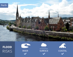
Where the River Tay begins to widen and meet the ocean, there is a coastal flooding risk. Only a small portion of Perth is affected by this risk to the south, with fewer homes and businesses in these areas.
Further up the River Tay, surrounding areas are at high, medium and low risk of river flooding. The River Almond threatens local homes and industrial sites to the north of Perth, while the majority of the city centre is untouched.
There are several strings of surface water flooding risks dotted throughout Perth, with a medium risk along the rail line heading north from the station. Scattered across developed areas as well as rural areas, surface water flooding is something for all residents of Perth to consider.
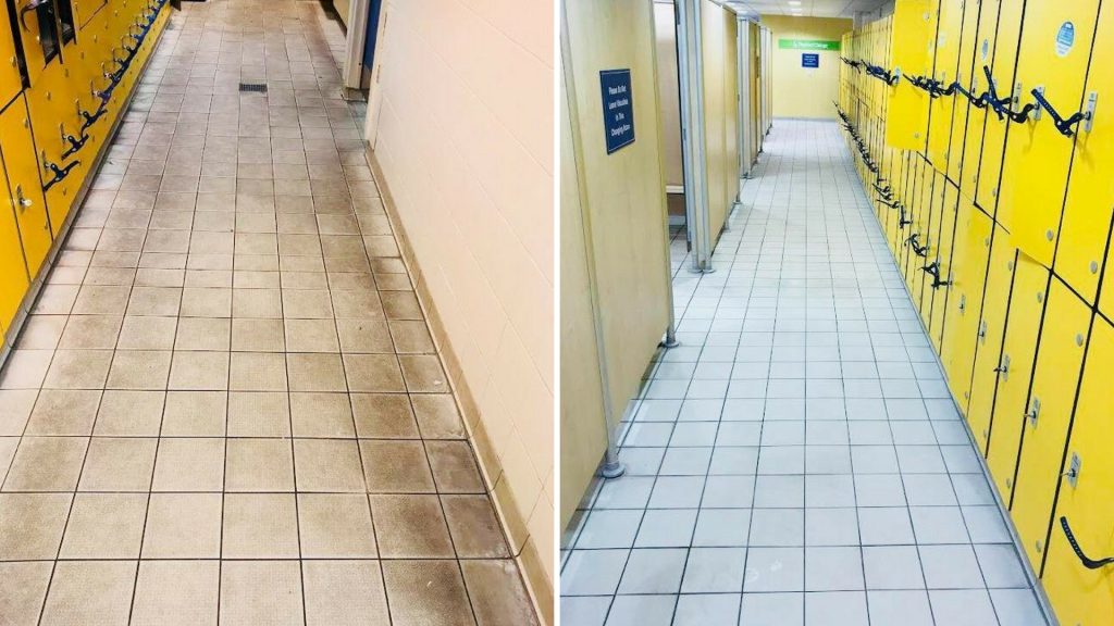
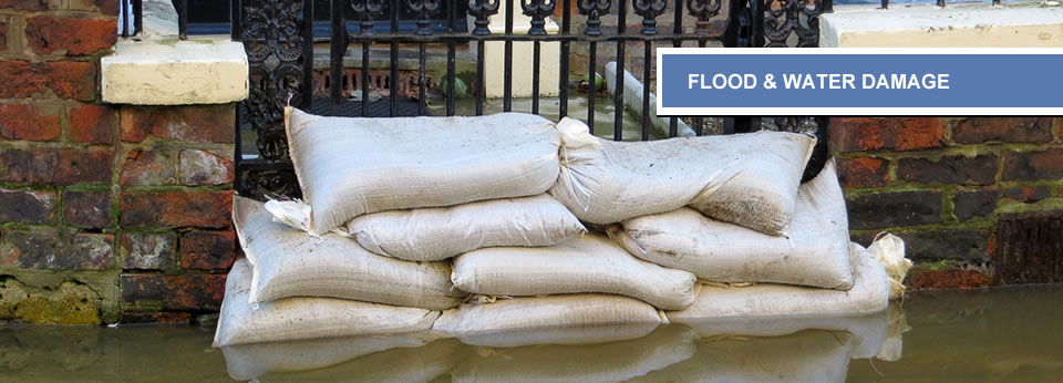
Finding an emergency cleaner
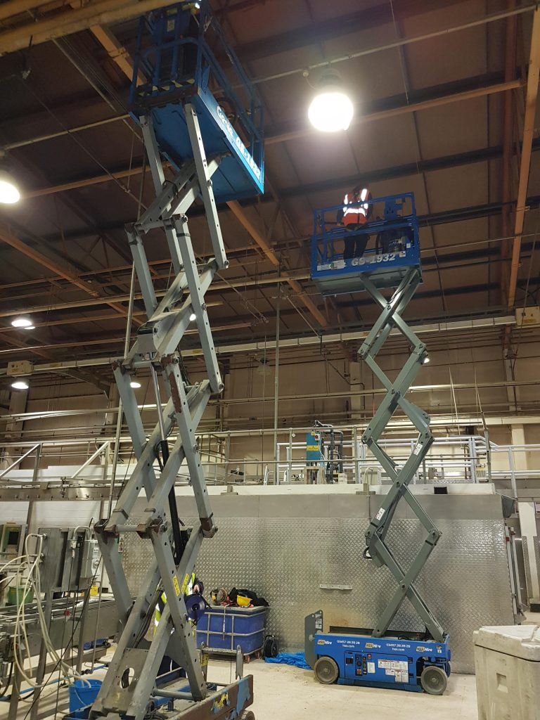
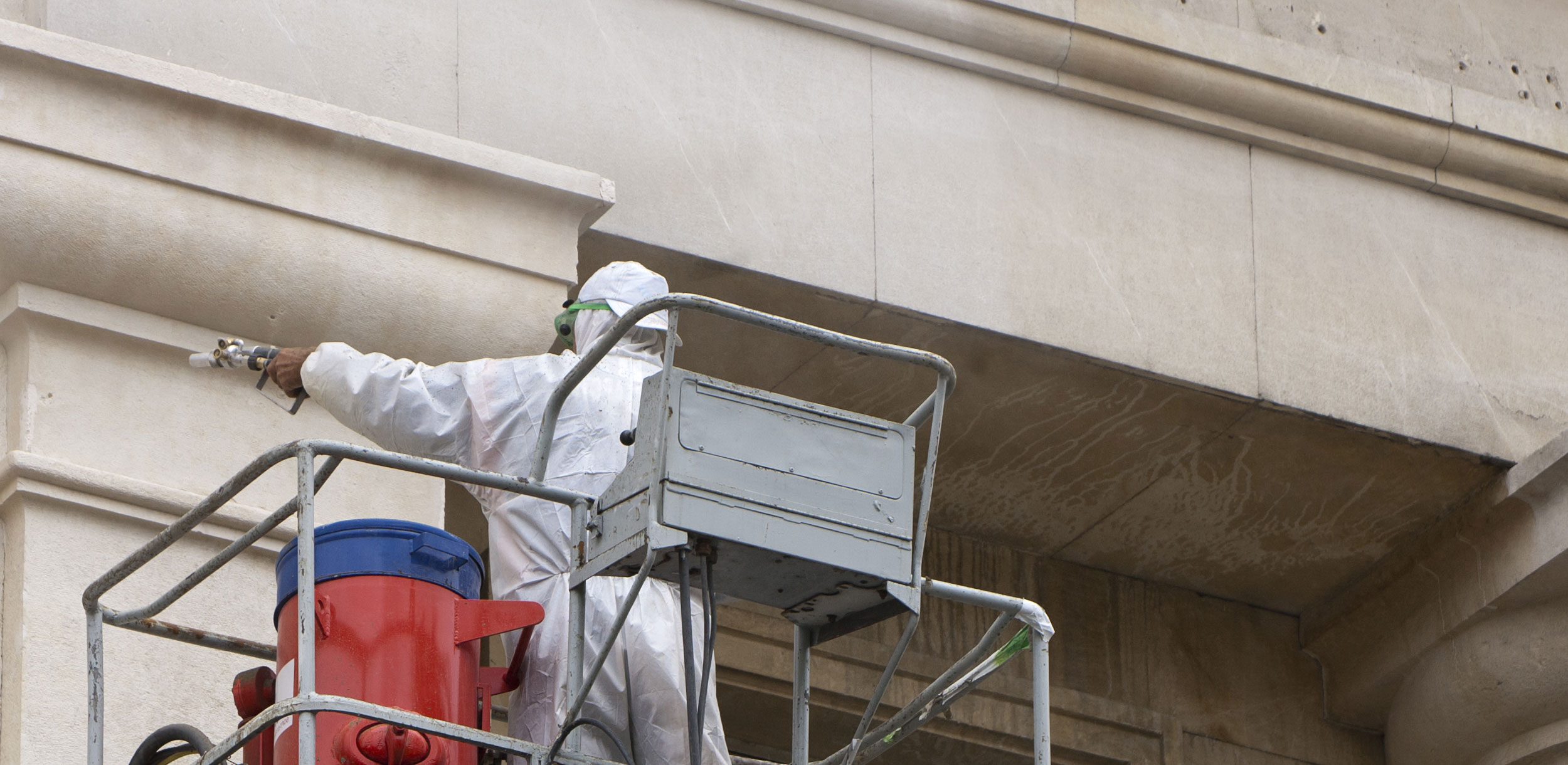
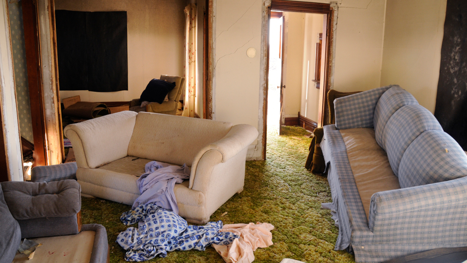
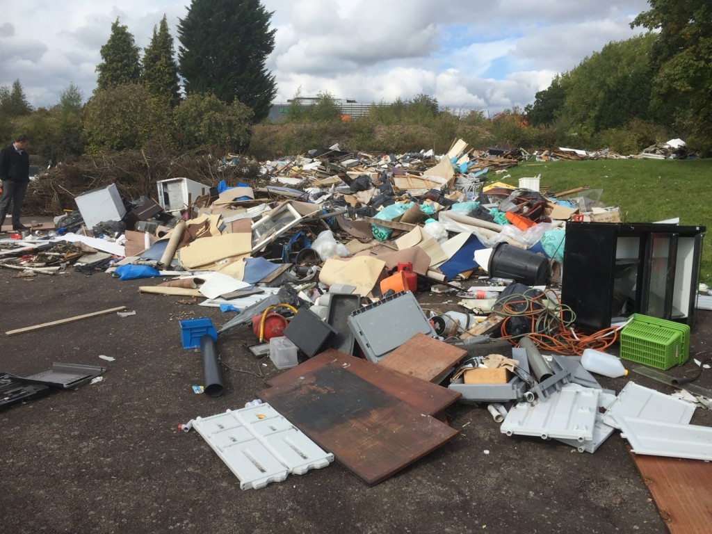
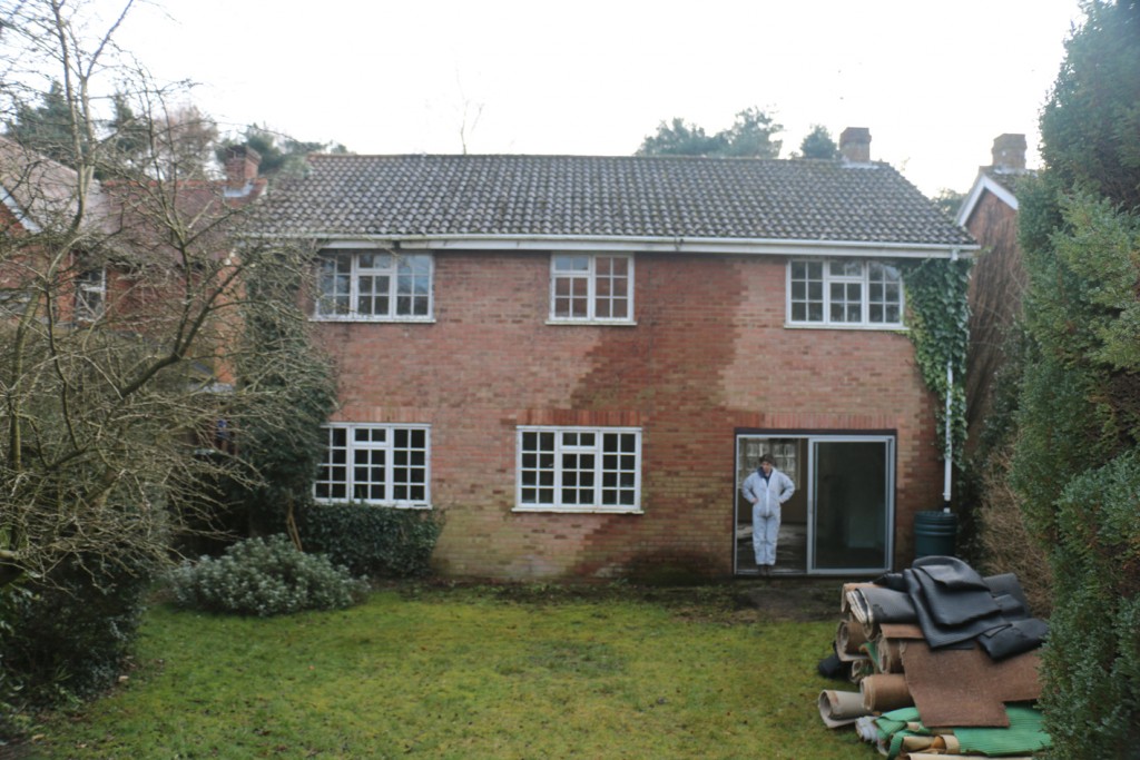
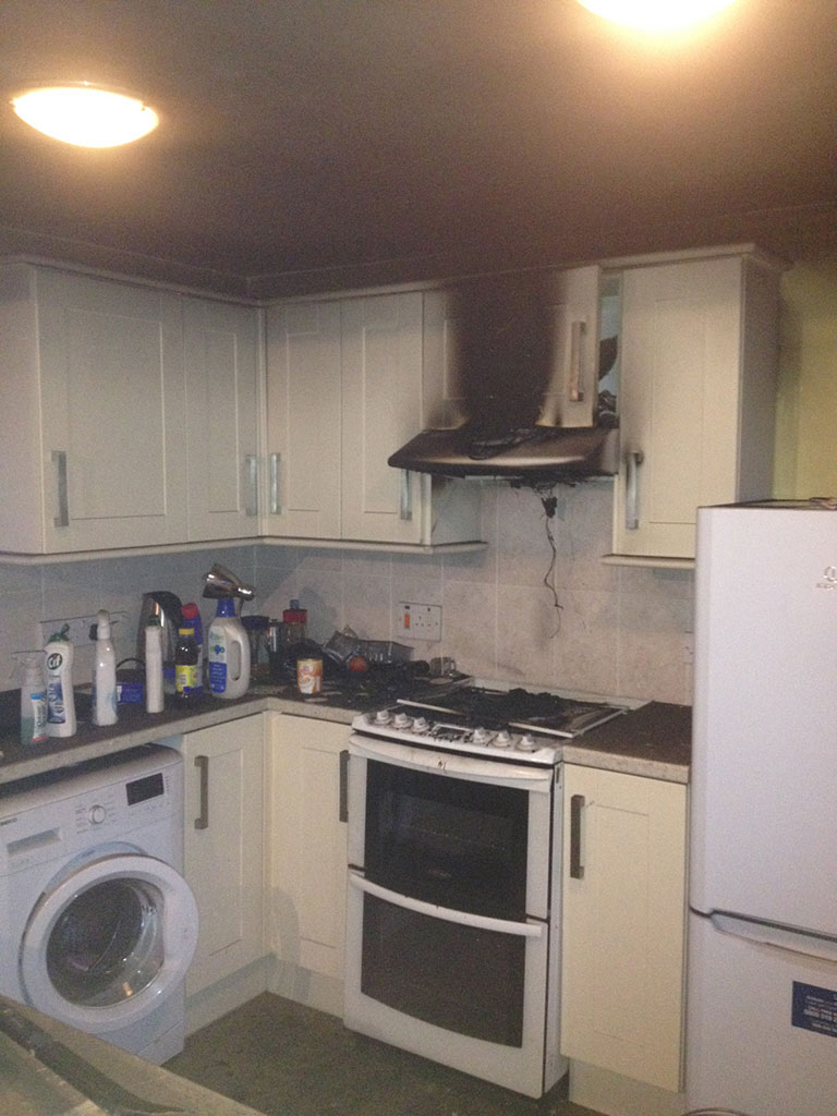
When flooding hits your home or business it’s vital that you seek an emergency cleaner to clear the flood water, rescue property and help you get back on your feet.
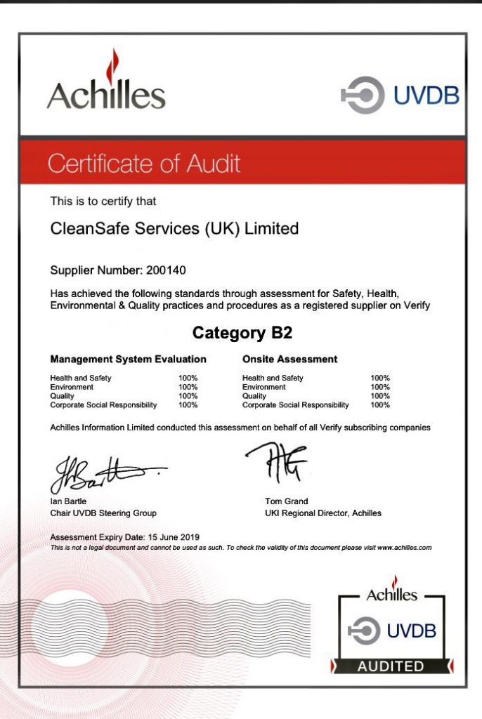
CleanSafe provide emergency cleaning for flooding for the whole of Scotland, ensuring anyone affected by flooding – whatever the cause – can quickly and effectively clean and restore their property.
Contact CleanSafe today for more information about emergency cleaning services for Scotland. Alternatively, fill out the online contact form with the details of your enquiry.